Pedaling to the Pacific
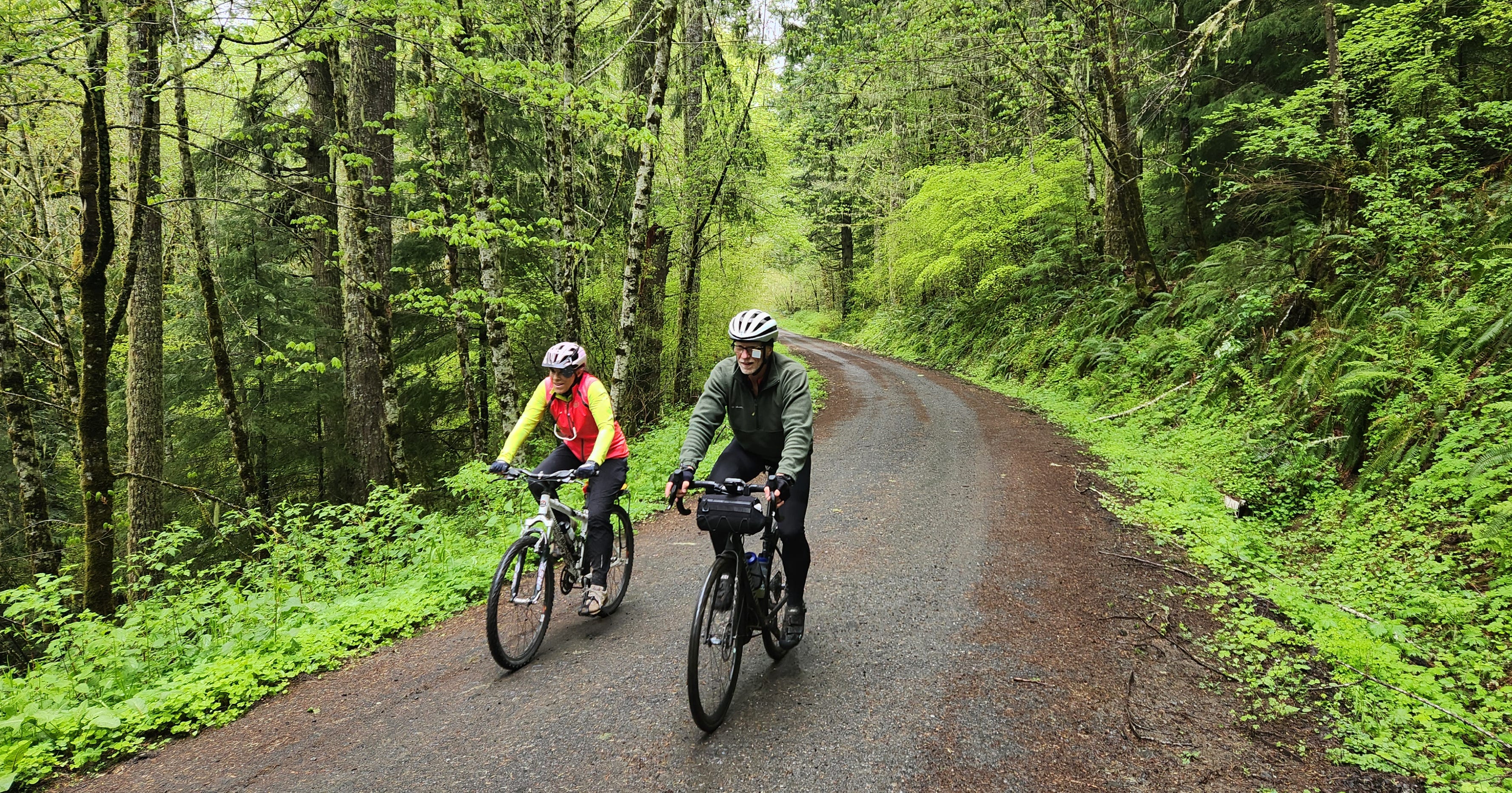
OREGON: The Corvallis-to-the-Sea Trail stretches west from Corvallis, crosses a mountain range, and ends at the beach during this backcountry adventure.
Our bike tires roll over the relatively smooth asphalt. Enjoy this, we agree, because the road will get rough before our day is done.
We’re pedaling deep into the Oregon Coast Range along the Corvallis-to-the-Sea Trail, a 56-mile bike ride from the Willamette River to the Pacific Ocean. We’re working our way uphill along Old Peak Road west of Philomath through thick forests and across open spaces where tall trees once stood.
We left Corvallis this morning to cross Benton and Lincoln counties and eventually arrive at Ona Beach south of Newport. The route, designed and developed by a legion of volunteers over more than two decades, leads hikers and bikers along paved streets, gravel roads, double-track paths, and narrow trails.
Time matters: we need to reach the sea by sunset. That sense of urgency evaporates, however, once we pause and look down on mountain slopes blanketed with deep green forests. This is wilderness.
The Corvallis-to-the-Sea (C2C) Trail starts along popular, paved paths west from the city to Philomath before heading into the hills. There’s our 56-mile bike route and a 60-mile hiking trail, and numbers compiled by the non-profit Corvallis-to-the-Sea Trail Partnership indicate about 500 hikers and 300 bikers spent time here in the woods in 2023. Several access points along the way make it possible for some to select a segment and enjoy a short day outing. Multi-day travelers can camp in designated areas each night. We’re going the distance in one day.
The C2C Trail provides “a sense of remoteness while also being geographically accessible,” says Jim Blount, a trail ambassador. “It’s situated between two cities that have all the amenities one would need.”
What’s in between?
“Solitude,” Jim says.
The reward is the ocean. “I think there's just something really special about starting in the valley, crossing the entire coast range, and then ending at the beach,” he says.
Reaching the Summit
Ona Beach is our goal, but we first must crest the mountains. We accomplish this by the 19th mile, reaching the trail’s summit at an elevation of 1,780 feet. There’s no jaw-dropping, take-your-breath-away view here, only a small parking area carved from within the forest at the junction of gravelly Woods Creek Road and hard-packed North Ridge Trailhead.
Hikers can detour south from the C2C path to famed Marys Peak, the highest mountain in the coast range. Our course heads west on a degrading road that bumps and undulates until it ends almost 5 miles later at a steel barricade.
We are alone. Carrying a satellite phone was a good idea; we’re too deep in the trees, too far from civilization to capture a cell phone signal. We have our GPS navigation, and the trail is well-marked.
We wave goodbye to our support vehicle driver and roll on. The surface transitions from difficult rocks to manageable twin tracks of pebbles and dirt and eventually to one thin groove in the foliage that turns harrowing for the inexperienced mountain biker. We follow the switchback footpath down a slick, wet slope and roll across a forest floor still soggy from spring rains. We laugh as we balance our bikes through slippery mud, giddy about riding through this dense, green undergrowth.
The Preparation
We planned ahead for this adventure, first by purchasing a paper map at Peak Bike & Outdoor in Corvallis weeks in advance so we could study every aspect of the adventure. The map includes important safety and risk information, detailed depictions of each trail section, area history, and descriptions of what we may find. Route explanations and a map (in GPX file) are also available on the Corvallis-to-the-Sea Trail Partnership website (c2ctrail.org).
It’s also important to visit the website a final time before departing. There may be trail updates or closures that affect your plans.
We also obtained a free trail permit from Starker Forests (541-929-2477) allowing us to legally cross private lands. Jim Blount recommended bicycle tires be at least 40 millimeters (mm) wide, so we checked to be sure we could ride over rough surfaces.
Our support vehicle carried plenty of water because drinking water is scarce. Safe water sources are marked on the map, but any natural water found along the way must be boiled or treated before drinking.
Finally, we added our names to a trail register stationed at informational kiosks on the route. This helps the C2C partnership count how many people are using the trail.

The Final Miles
We’ve rarely seen another car or truck all day. We pass the one-time timber town of Harlan about 25 miles from the ocean and in time rejoin easy, comfortable gravel roads as they follow Beaver Creek downhill toward the sea. Douglas firs, hemlock, maple, and alder trees give way to bucolic meadows where cattle look up from their grazing to see us pedal by.
Rocks under our wheels finally disappear and smooth pavement leads us to Highway 101, Brian Booth State Park, and Ona Beach. Sounds of a gentle wind rustling trees, birds singing, and tires grinding on gravel are gone, replaced by surf and a sea breeze.
Dan Shryock is a travel writer and career journalist who focuses on cycle tourism. Based in Oregon, his work has appeared in magazines and websites in California and the Pacific Northwest. His book, “Cycling Across Oregon: Stories, Surprises & Revelations Along the State’s Scenic Bikeways” is available on Amazon.