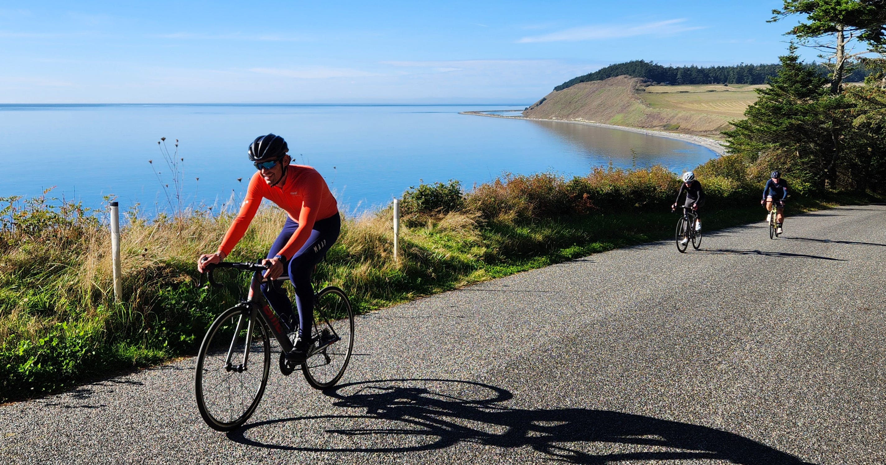
Riding Whidbey Island
WASHINGTON: Discover rolling hills and quiet roads only a ferry boat away

I am enamored with Washington’s greater Puget Sound region. With so many cycling destinations, choosing where to ride is sometimes difficult. No matter where I look, I find what I want – quiet roads, varied landscapes, good views, and some elevation change.
The problem becomes deciding. The San Juan Islands receive plenty of justifiable praise. Port Angeles delivers both the easy-to-follow Olympic Discovery Trail and the extreme climb to Hurricane Ridge inside Olympic National Park. For those looking for a Canadian experience, there’s the ferry from Port Angeles to Victoria, British Columbia.
Somewhat overlooked in all this is Whidbey Island. There’s much to say about Whidbey, so here I go.
The Cycling Experience
Whidbey Island, as well as the greater Puget Sound region, was formed by cycles of glacial movement and material deposits 13,000 to 18,000 years ago. As ice cut through bedrock and created deep troughs, displaced rocks, clay, sand, and other materials were plowed to the side.
Once the glaciers retreated and sea levels rose, these newly created islands remained above water. This random earth movement created inconsistent geography. There are rolling hills in some areas and flat plains in others.
As cyclists, we reap the benefits. There’s something for everyone to enjoy here.
When I investigate a new area, I typically go to RidewithGPS.com and explore popular routes already in the massive online map system. On Whidbey Island, however, I first revert to an old-school paper map. Spreading a copy of “A Bicyclist’s Map of Island County” across the table, I review what’s available. The color-coded map illustrates recommended roads, traffic levels, and road shoulder qualities. Hills are indicated when grades reach 4 to 7 percent and again when they are greater than 7 percent.
Once I have some ideas, I find the navigational maps on RidewithGPS and download them to my phone.
Where to Find Maps
The free bicyclist maps, produced by Island County Public Works, are available at island visitor centers, libraries, bicycle shops, and at the Island County Public Works office, 1 NE 6th St. in Coupeville.
Maps are also available by contacting the Embrace Whidbey and Camano Islands tourism office.
Three Options
Flat and Easy – While this is an island of hills, there are flat stretches to enjoy. Try starting at the Port Townsend-Coupeville Ferry dock on the island’s west side and follow Engle Road toward Coupeville, a small waterfront town. Fort Casey State Park, a former U.S. naval installation, appears on the left only minutes after the start.
Coupeville is only 4 miles up the road, but I detoured onto Hill Road for a pleasant descent to a gravel beach and historic Ebey’s Landing. Once on Ebey’s Landing Road, I cruised past flat farmland and into Coupeville.
This community has been settled for centuries, originally by the native Snohomish, Kikialus, and Lower Skagit people. Then came European settlers in the late 1700s, and eventually by namesake Captain Thomas Coupe in 1852. It’s a quiet community with a short waterfront business district. Anyone in search of caffeine should walk the bikes to the end of the pier and enjoy freshly roasted drinks at Beaver Tales Coffee.
Country Rollers – Aside from the farm fields south of Coupeville, long stretches of flat road are rare. Short, rolling hills throughout the island are constant, but not difficult. Shifting up and down the cassette, I explored southern Whidbey during two 25-mile rides. Each trip covered quiet back roads with alternating forests and meadows. Also consider an 11-mile coastal spin around Penn Cove between Coupeville and Oak Harbor.
Test Yourself – Looking for a challenge? Pedal up Saratoga Road north from Langley. There’s a short, beautiful ride along the coast past Bells Beach to an enclave called Baby Island Heights. If those hills are appealing, look for more on nearby Brainers and Amble roads.
How to Get There
I first discovered Whidbey Island while researching an article where I used the Amtrak Cascades rail line for a week of Pacific Northwest cycling. I wanted to include a unique destination close enough to reach by bike from an Amtrak station. I found I could ride 9 miles from Everett to Mukilteo and then ride a ferry to the island.
There are three ways to reach the island. Two vehicle ferries sail to Whidbey, the Clinton-Mukilteo arrives from the east and the Coupeville-Port Townsend travels from the Olympic Peninsula to the west. It’s also possible to drive in from the north across the Deception Pass Bridge.
Ride the Bus
Take advantage of the free bus service to navigate Washington State’s largest island. Heavy, fast-moving traffic makes Highways 20 and 525 unsafe cycling roads. Local riders wishing to safely move north and south ride Island Transit. There’s a bike rack on the front of each bus. Information is available at islandtransit.org.
Dan Shryock is a travel writer and career journalist who focuses on cycle tourism. Based in Oregon, his work has appeared in magazines and websites in California and the Pacific Northwest. His book, “Cycling Across Oregon: Stories, Surprises & Revelations Along the State’s Scenic Bikeways” is available on Amazon or online through your favorite book store.


