


A Coastal Bucket List Ride
CALIFORNIA: Discover San Diego County's high points, vistas and beaches from Point Loma to Encinitas.

The tiered climb to Mt. Soledad is a challenge. It’s a slow, steady push for nearly four miles up Soledad Mountain Road near the San Diego coastline, and the bike lane through this residential neighborhood tilts as much as 10 percent in spots.
Each pedal stroke is worth the effort.
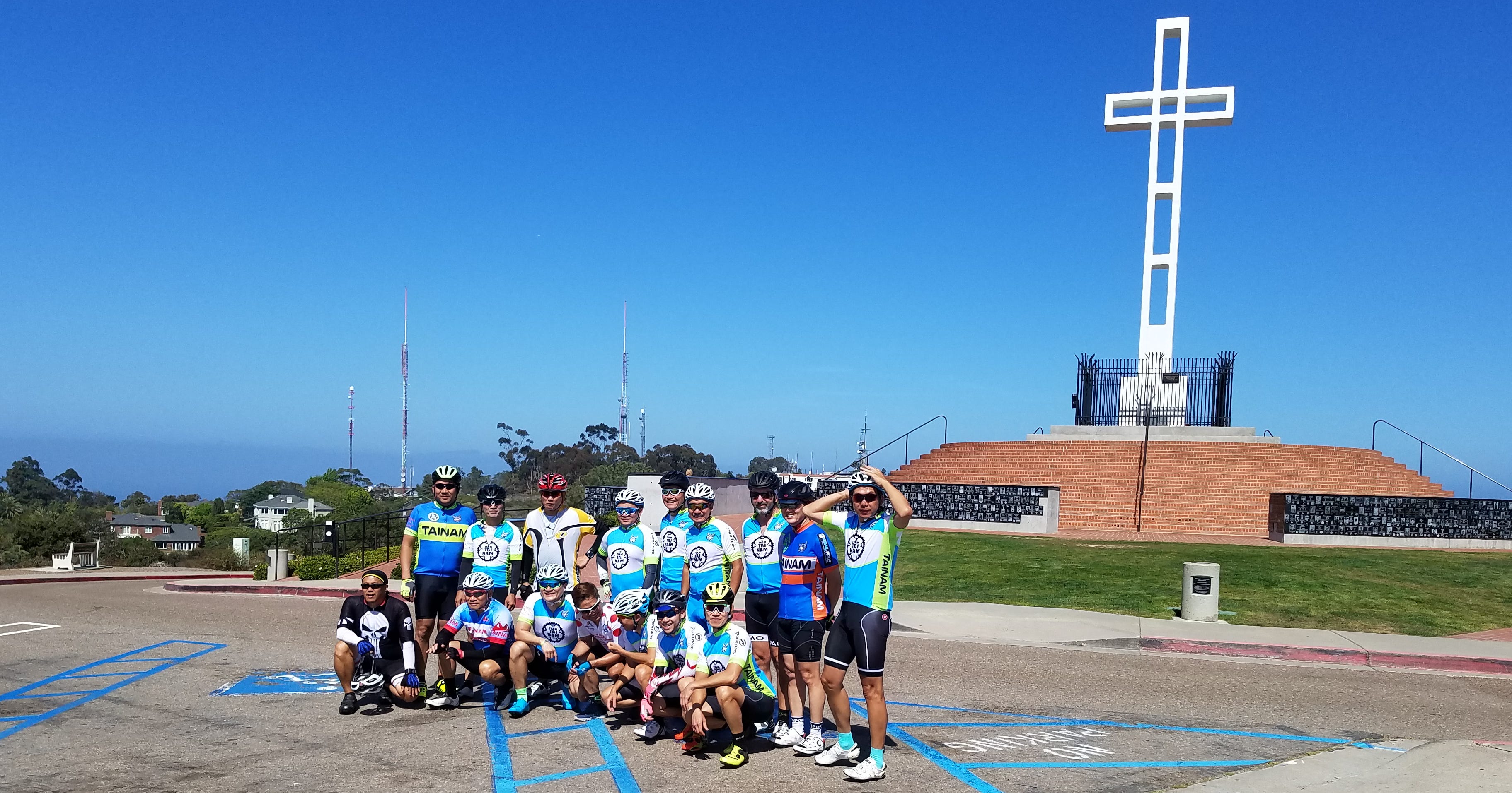
The Mt. Soledad National Veterans Memorial, with its towering white cross at 823 feet in elevation, is a San Diego landmark. From the memorial, there’s a 360-degree view of the Pacific Ocean, coastline, the city below, and distant mountains to the east.
I’m in San Diego for a family visit, and I’ve set aside time to ride with longtime friend Mark Oemcke. Mark targeted the Mt. Soledad climb early in our planning process. And as we wearily roll into the veterans memorial parking lot ready for rest and rejuvenation, we discover we are not the only ones who made it to the top. Sixteen members of a local cycling group are scattered on the grass, each recovering in their own way.
Some lie on the ground as if a quick nap is in order. Others take pictures, check their bikes, or simply quietly sip from water bottles. Soon, like us, they will be continuing north along one of the most picturesque rides imaginable – the San Diego coastline.
This is a bucket list ride for me. Our family lived in San Diego for many years before moving to Oregon. I had not discovered cycling at that time, however, and didn’t realize the opportunities in my own hometown. Once I started riding, I decided I needed to return and ride along the coast.
Start at the Water’s Edge
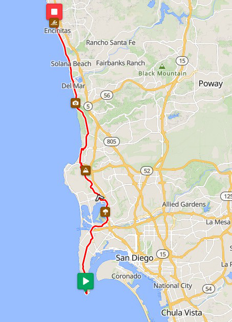
I’m finally straddling my Specialized at the Cabrillo National Monument, our starting point at the southernmost edge of Point Loma. At 8 a.m., as if to signal our Grand Départ, the sound of the National Anthem reverberates from outdoor speakers at Naval Air Station North Island (Coronado) nearly 3 miles to the east. It’s time to go.
Mark will lead me through nearby neighborhoods, across Mission Bay, across La Jolla, down from Torrey Pines State Natural Reserve, and on through the beach towns of Del Mar, Solana Beach, and Encinitas. The experience exceeds expectations.
Note: There is a daily entrance fee to Cabrillo National Monument. Check the website for information.
So many options
Our planning started months earlier as we considered how to execute this ride. Should we start at Oceanside in the northwest corner of San Diego County and head south through the succession of beach communities? Or, start on the south end? Do we want to do some climbing or simply enjoy a flat, peaceful day on the bike?
San Diego’s diverse coastline provides so many entry points, so many terrains that we could start just about anywhere and enjoy a nice ride. In the end, we decided to take advantage of this diversity and sample just about everything.
Ride with a friend
An out-of-towner like me would have a difficult time navigating this ride alone. Mark’s local knowledge of intricate road patterns, high-traffic areas, and shortcuts around problem spots made our ride much easier. Cyclists without in-town connections can turn to local bicycle clubs or bike shops such as UC Cyclery in La Jolla for advice.
Mark also knows how to make the most of each highlight along the way. We start near the ocean’s edge on Cabrillo Road with an expansive view before a short 350-foot climb from the waterline to Fort Rosecrans and on to Cabrillo Memorial Drive. We then glide down through neighborhoods as payback for the early uphill work.
That would become the day’s mantra: Good efforts are quickly rewarded.
We make our way along busy Nimitz Boulevard, past SeaWorld San Diego, and onto bike paths through Mission Bay where we ride slowly to avoid collisions with runners, walkers, and small children. We reach the Mt. Soledad summit, rest, and depart, plummeting down Via Capri and Hidden Valley Road with descents as steep as 16 percent that test our fortitude, brakes, and hands.
Torrey Pines and the Big Glide
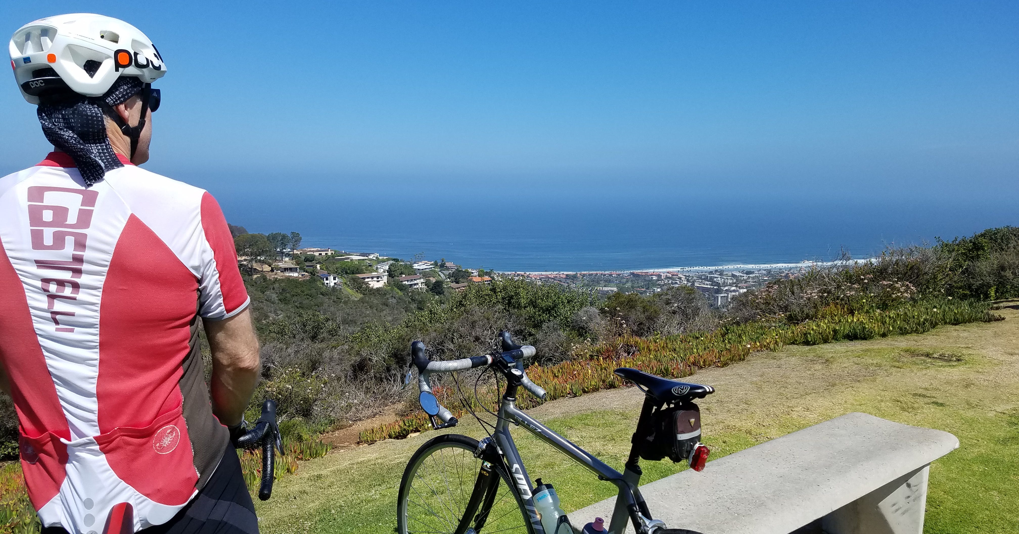
After passing through La Jolla Shores and the Scripps Institution of Oceanography campus – watch out for a short, nasty climb at Scripps – our route leads us to North Torrey Pines Road and an exhilarating downhill glide.
I am disappointed when Mark says our route will not follow the narrow roads of the Torrey Pines State Natural Reserve. For safety reasons, no northbound downhill cycling is allowed in the park. We were relegated to the main road and its traffic. Still, we have a wide shoulder as we sail nearly two miles and more than 400 feet down to Torrey Pines State Beach. I can’t help but laugh with excitement as I look down at the road rushing under my wheels.
I’m not the only cyclist wearing a smile. As we pause by the beach, riders stream past us, each whooshing by with big smiles and waves of hello.
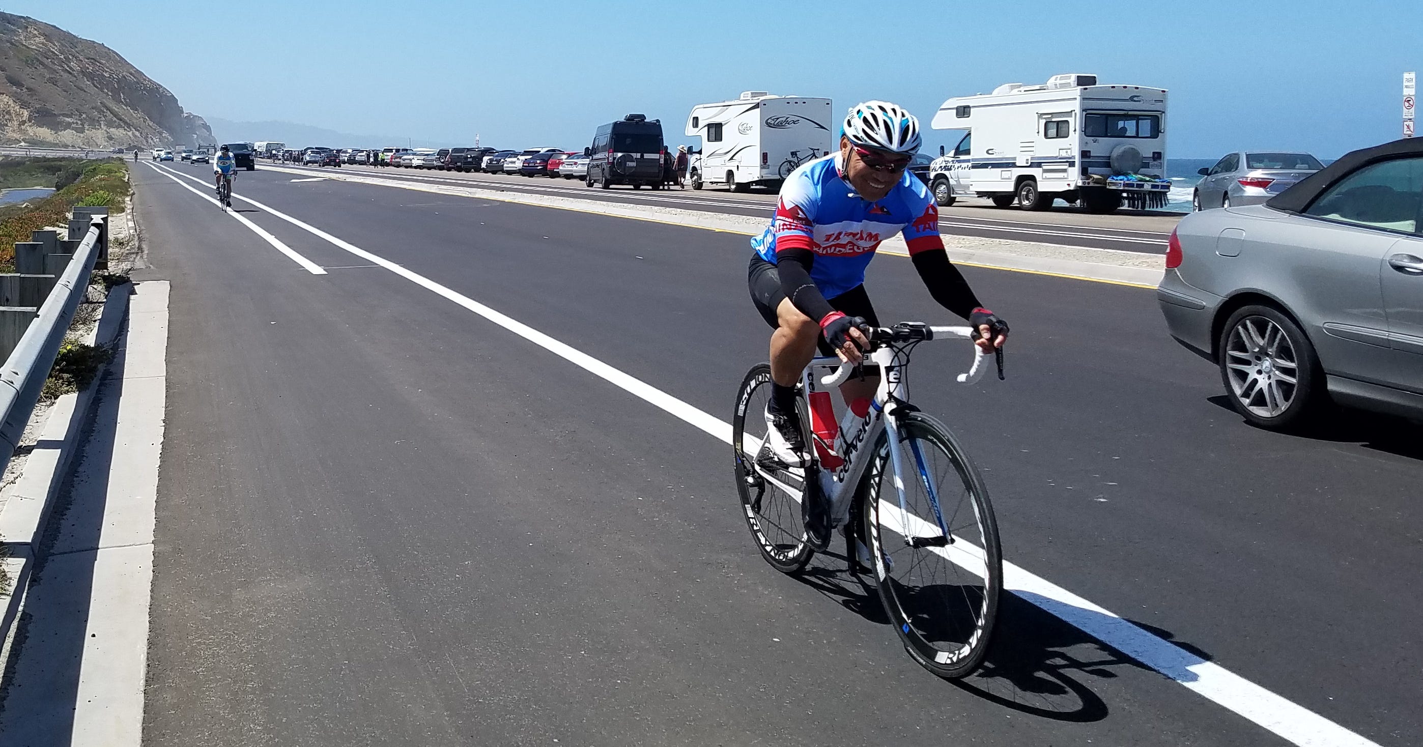
The remainder of our ride follows Highway 101 through the coastal communities, where we slowly roll with weekend traffic. That is to be expected as we make our way to Encinitas, a waiting car at Moonlight Beach, and a rewarding lunch. In all, we travel more than 32 miles, climb 1,880 feet, and are still ready for more.

Dan Shryock is a travel writer and career journalist who focuses on cycle tourism. Based in Oregon, his work has appeared in magazines and websites in California and the Pacific Northwest. His book, “Cycling Across Oregon: Stories, Surprises & Revelations Along the State’s Scenic Bikeways,” is available on Amazon.