
Summiting Oregon’s McKenzie Pass
ROUTE BREAKDOWN: Here are 3 ways to approach the state’s iconic Cascade Range ride

Note: This is a new post in my “Breakdown” series which takes a closer look at featured cycling routes throughout California and the Pacific Northwest.
There are few climbs in the Pacific Northwest as accessible and popular as McKenzie Pass in Oregon’s central Cascade Range. It’s a bucket list ride for some, an annual tradition for others.
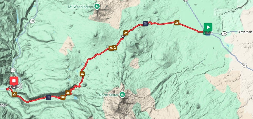
There are three ways to scale the mountain along Highway 242, the McKenzie Highway, and all three have their rewards. One can ride up the western slope through the Willamette National Forest and turn around at the summit. Another option is to start in downtown Sisters and make an easier ascent up the eastern side before returning to town.
The third and most challenging is to go 38 miles one way up, over and down, take a break, and then reverse for a repeat in the opposite direction.
I’ve gone all three ways and while I have my preferences, all three are worthy challenges.

When to Ride
This route is called the McKenzie Pass Scenic Bikeway, one of 18 state cycling routes that represent the best in Oregon bicycling. Snow closes the McKenzie Highway each year, typically in late October or early November, and the road remains closed until the Oregon Department of Transportation (ODOT) swings open the gates on the third Monday in June.
Some cyclists, however, don’t wait and they start pedaling as soon as the snow is gone. Don’t be surprised to see hundreds of cyclists streaming up and down the eastern slope on a May or June weekend.
(Video provided by the Oregon Department of Transportation)
But this rogue riding frustrates ODOT officials who stress that bypassing locked gates and warning signs is not safe. “There is little snow at this point, but we still have work to clear winter debris such as downed trees, rocks and limbs,” spokesperson Mindy McCartt told me today (May 29). “The McKenzie Highway closure is in place so crews can safely complete the work needed to prepare (the highway) for reopening.”
(For more on this issue, see “The McKenzie Pass Conundrum”)
ODOT is not an enforcement agency and will not patrol the road. They count on cyclists to use good judgment. So the next decision focuses on how to approach the day. Here are some ideas.
Option 1: Sisters to Sisters
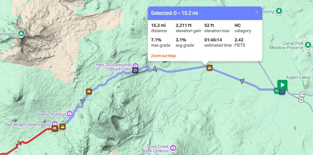
This is the most popular choice. The city of Sisters creates an excellent launching point and a perfect place for a post-ride celebration. It’s also the least taxing effort. That’s because the city, at 3,189 feet elevation, is higher than Belknap Springs, the western start at 1,670 feet. Simply put, it’s a shorter push to the summit’s 5,325-foot elevation.
The 15 miles to the top feature Central Oregon’s well-known high desert landscape – scrub brush and ponderosa pines – before the trees eventually yield to the jagged basalt rock that blankets the mountaintop. The highway cuts a narrow path through the basalt, which originated as lava flowing from local volcanoes more than 1,300 years ago.
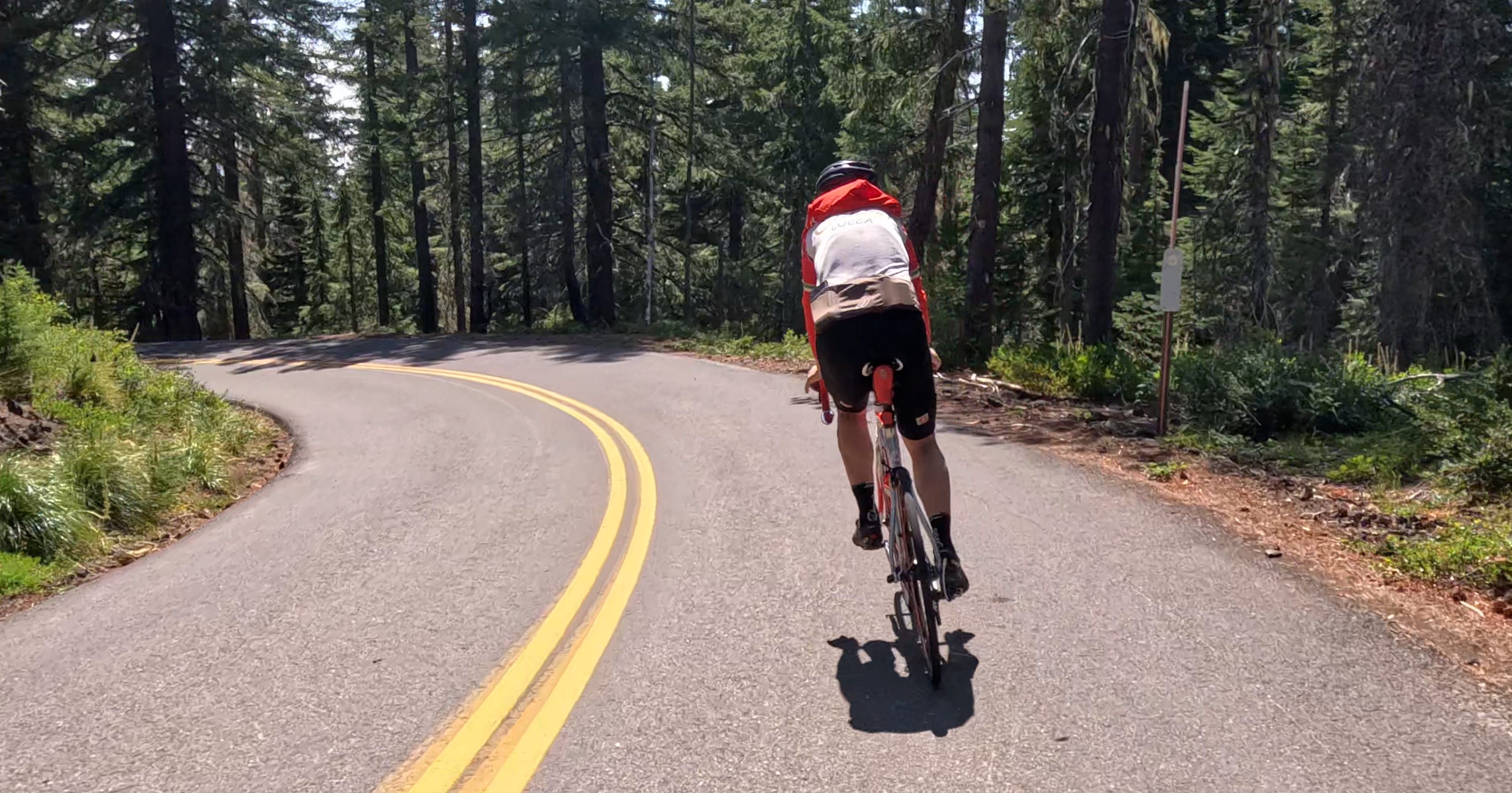
The eastern slope ascent.
Downhill from the summit toward Sisters.
The road surface, repaved in 2024, remains smooth two years later and provides one of the sleekest, fastest descents one can hope to find.
RidewithGPS.com rates this as an “HC” climb, primarily because of the distance and grade of the climb. (Here’s an explanation.)
The term hors catégorie or “HC” is used by the Union Cycliste Internationale (UCI), the international governing organization for professional cycling, to grade hills. The UCI rates roads based on a formula that scales degrees of difficulty. A Category 4 is easiest, and a “Cat” 1 is really hard. An HC status – hors catégorie in French means beyond categorization – is the most difficult, with measurements so extreme that they exceed the official scale.
The key resource in Sisters is Eurosports bike shop a block from Village Green City Park and the start of the scenic bikeway. Food trucks and cold drinks are available there.
Option 2: Belknap Springs and the Western Slope
There’s a risk/reward when ascending the western slope.
First, the benefits. The ride twists and turns for miles through a deep, shaded forest of Douglas fir before finally breaking across the tree line and finishing among the basalt rocks. And as fast as the descent is on the Sisters side, the westside ride back down to Belknap Springs is longer, faster, and technical. All that equals more enjoyment.
The disadvantage? It’s a longer, harder, steeper lift.
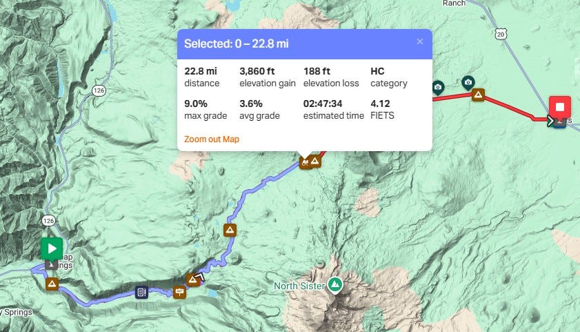
How much harder? The climb, also rated HC, is nearly 23 miles to the top with 3,860 feet of gain.
I prefer this side of the mountain because I love riding in the trees and it’s a thrill to glide back down. I temper each climb with frequent water breaks and photo opportunities. That’s my excuse, at least.
The route starts at the modest junction of Highway 126 and Belknap Hot Springs Road, the entrance to Belknap Hot Springs lodge and cabins.
A side note: The Aufderheide Scenic Bikeway terminus is located 9 miles west of this spot on Highway 126.
Early miles start flat and then gradually tilt up, allowing the legs time to warm up. But by the 10-mile mark, muscles are feeling the full effect. The slope starts to level off after about 15 miles, but the climb never ends until the summit and the Dee Wright Observatory parking lot.
The return trip is one of joys of Oregon cycling. It’s a fast, twisting course back through the forest. Grab the brakes and go for it but stay in the right lane at all times. Bikes are navigating uphill and motor vehicles join in from mid-June on.
Descending the western slope toward Belknap Springs.
Option 3: Over and Back Over Again
This is a serious effort. 76 miles, two HC climbs, and more than 6,000 feet of elevation gain. Plan carefully before deciding which slope to attack first. There are no services and no water on this route.
There are several places to eat, drink, and rest in Sisters if that’s the turnaround location. But beware if you start east to west. Food and drink at Belknap Hot Springs are limited with inconsistent hours of operation. Check the website for details.

Dan Shryock is a travel writer and career journalist who focuses on cycle tourism. Based in Oregon, his work has appeared in magazines and websites in California and the Pacific Northwest. His book, “Cycling Across Oregon: Stories, Surprises & Revelations Along the State’s Scenic Bikeways” is available on Amazon.
Dan, thanks for the breakdown of options and the cool videos! We are going for Option 1 later this month!
Fantastic info, Dan. Love the videos as well...the landscape is breathtaking. I look forward to doing it soon!